An evocative itinerary following in the footsteps of Edward Lear

top-Sentiero dell'Inglese

Naturalistic

Apr 3, 2022 10:40 AM

Travel information

Category

Naturalistic

Target

Amici/Solo coppia

An evocative itinerary that follows in the footsteps of Edward Lear, an English artist in love with Calabria, to discover the most fascinating side of Aspromonte.
Edward Lear, an English writer and illustrator who lived in 1800, was in love with Italy. 
He travelled in the Roman countryside, in Abruzzo, and then in Molise, but it was Calabria above all that won him over: in 1847 he visited the province of Reggio, unable to go elsewhere because of the riots in Reggio. His Journals of a Landscape Painter in Southern Calabria, published in England in 1852, is a fascinating account of that Calabrian and Lucanian journey. 
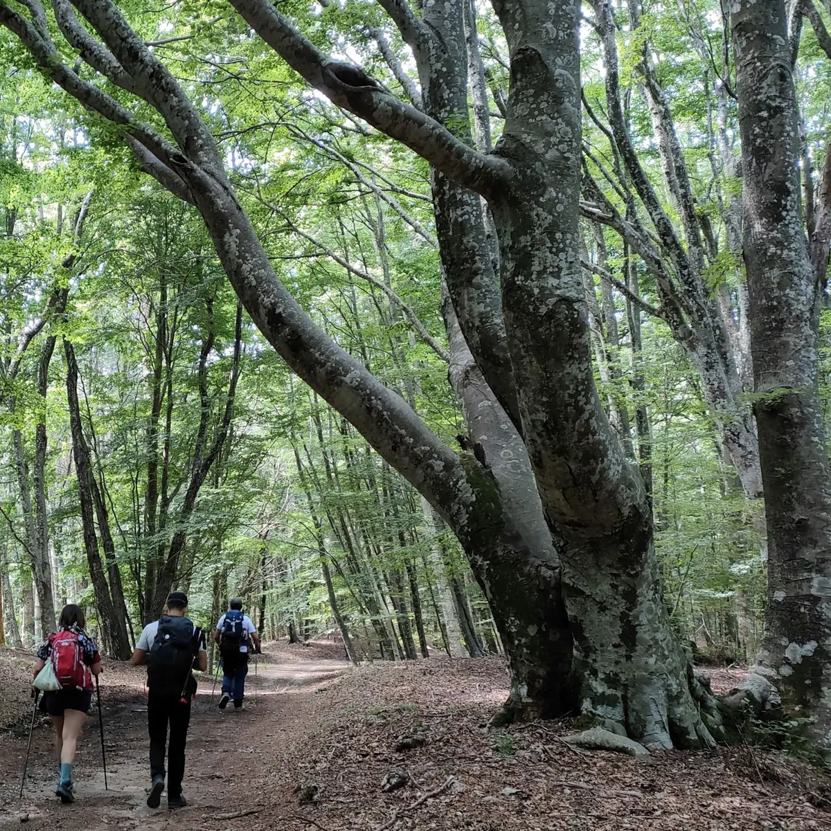
In the company of a friend and a donkey, Edward Lear treated himself to a walking tour of Aspromonte. And it is on those footsteps that the Sentiero dell'Inglese (Englishman's Path) passes today, a trek that skirts the Aspromonte National Park and can be covered in a week, starting from the splendid village of Pentedattilo and ending in Staiti. A splendid itinerary, crossing the Grecanica Calabria of Amendolea di Condofuri, Gallicianò and Bova.

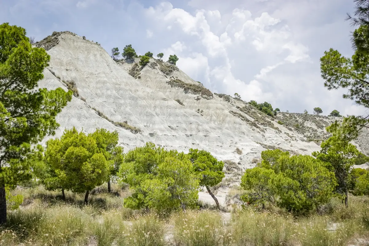
We are in the Aspromonte National Park, an area of great biodiversity due to its geographical position (at the centre of the Mediterranean) on the Ionian and Tyrrhenian sides, with different microclimates and therefore great heterogeneity of landscapes and habitats, from the Mediterranean maquis with tall holm oak woods, unique on the Peninsula, from the vast natural pine forests to beech woods, with valleys furrowed by the characteristic "fiumare", beds of watercourses with a non-constant flow rate that in summer are rivers of pebbles and stones.

The entire route is reserved for experienced hikers and it is suitable in spring, summer and autumn.

Stop 1 - Melito di Porto Salvo

Go to the destination

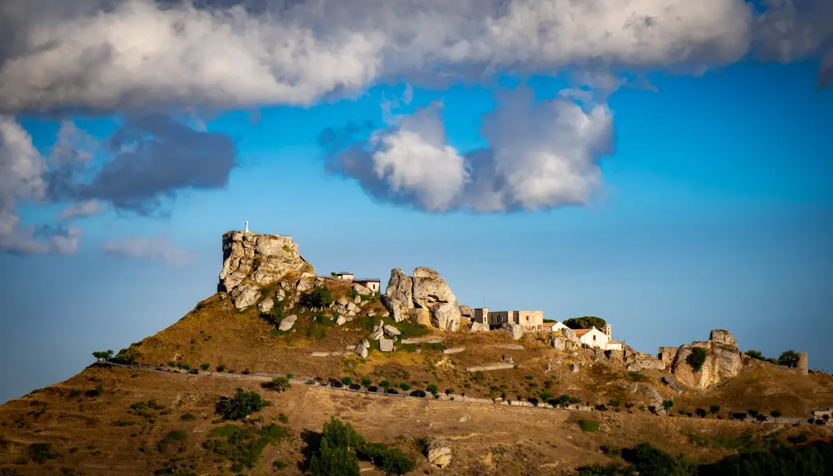
Pentedattilo is a village abandoned in the 1960s, located in an almost inaccessible area of Aspromonte, where it remained hidden for decades among the mountains. Behind it is a hand-shaped peak from which the village takes its name, partially collapsed due to landslides that caused its abandonment. 
The village of Pentedattilo is not yet inhabited, but it is still populated by some of the old inhabitants who had moved a little further down the valley and decided to reopen some activities. Today there is a hostel, a bar, a restaurant and even a Museum of popular traditions, while agritourisms where you can also eat have appeared in the surrounding area. 
Pentedattilo is one of the most characteristic centres of the Grecanica Area of Calabria. During the Roman domination it became an important military centre thanks to its strategic position controlling the Sant'Elia river, a privileged way to reach Aspromonte.

Stop 2 - Bagaladi

Go to the destination

Bagaladi is not only one of the two gateways to the Aspromonte National Park, but also a small municipality with an extraordinary past. Starting from its name, which seems to be of Arab-Greek origin, this village is the splendid result of the mixture of many cultures. Famous for the production of a special olive oil, for years the livelihood of its entire population, Bagaladi is situated on a hill at the foot of Mount San'Angelo. The Frantoio Iacopino, one of the first oil mills to use water as motive power, is now one of the main entrances to the Aspromonte National Park. Now completely restored, this mill houses the Oil Museum and has become a place where ancient traditions can be relived.

Stop 3 - Condofuri

Go to the destination

Amendolea is an ancient village of Grecanic origin located on the river of the same name in the far south of the Calabrian peninsula. 
From the ruins of the village today stands the ancient Ruffo Castle, which, among the castles that the Normans built in mainland Italy after conquering the Byzantine lands, is certainly the one located further south. 
The castle, located in the north-western sector of a long and impervious rocky ridge that rises in the area where the Amendolea and Condofuri rivers meet, is at one with the high ground to the south-west, occupied by the monumental ruins of the village.
The isolation in which the village has always lived has allowed it to live according to its own customs and traditions as, perhaps, almost no other village has managed to do, and this has contributed to the defence of its ancient Greek origins, which have led to the construction of a small church in Byzantine style to try to reproduce the ancient Orthodox rite.

Stop 4 - Condofuri

Go to the destination

Gallicianò is a very small village, also known as the Acropolis of Magna Graecia in Calabria, as it is the only village still entirely Hellenophone, although the Greek language of Calabria is still used here. 
Thanks to its isolation, it has kept intact its cultural, craft, musical and choral traditions and has developed in its inhabitants a strong spirit of aggregation and hospitality, characteristics peculiar to the Greeks of Calabria. 
There are many elements that make the atmosphere romantic and full of emotion, such as the Fountain of Love, introduced by the words Cannalo Tis Agapi, so called because, according to legend, it was here that a local woman fell in love with a young man while washing clothes. 
Enveloped in such an emotionally charged dimension, it is impossible to overlook the Orthodox church dedicated to Panaghìa tis Ellada, or Our Lady of Greece, a place dear to all lovers as it is a location where couples usually get married in Orthodox Christian ceremonies.

Stop 5 - Bova

Go to the destination

Despite the outward signs of modernity, the world in Bova still seems to turn like a very slow wheel.
The ancient Greekness of the place was preserved and renewed at the arrival of the Byzantines, then survived the prevailing Latinity for many centuries. The rituals, language, traditions and above all a rare sense of hospitality recall its Greek roots. Those arriving in Bova are welcomed in a simple and spontaneous way by a community that has not lost the memory of its past, so much so that the names of the streets are also written in Grecanico. The small alleys that suddenly open up, the sunny square that seems to have been designed by De Chirico, the uninhabited houses where the landscape penetrates into the empty rooms: Bova is an environment of light and silence that invites calm and reflection.

This is a fascinating route through the archaic world of Calabria's Grecanic communities, walking along ancient paths beaten in the past by pilgrims, shepherds and traders, who descended from the mountains to Bova and vice versa, crossing the Campi di Bova plateau, with views of the Fiumare and the sparkling sea at the bottom, where Delia lies.
From the Punto Panoramico of Monte Grosso, at an altitude of almost 1400 metres, the view is splendid and embraces the panorama of the fiumara Amendolea, the abandoned villages of Roghudi and Africo vecchio and the other villages of the Area Grecanica, the peaks of Aspromonte with Etna on the horizon.

Stop 6 - Palizzi

Go to the destination

Palizzi combines all the elements of fairytale villages: a castle on a cliff, a medieval village at its foot and a donkey bridge that has spanned a waterway since the 14th century. 
Surrounded by superb nature, the village of Palizzi is the southernmost municipality of the Italian peninsula and clings to a sandstone cliff at the foot of the imposing castle.
A picturesque town, lying on the southern slopes of Aspromonte, which immediately fascinates the visitor for its purely medieval features, with the presence of palaces and solarate of imaginative architectural solutions, and then catoi, subways, stairs and curved tile roofs that offer a view of a landscape that has remained almost unchanged over time. Its territory corresponds to the most extreme part of the ancient region which, after being referred to as Esperia (land of the west) and Enotria (land of good wine) was called Italy.

Stop 7 - Palizzi

Go to the destination

The small village of Pietrapennata, named after the rocky ridges above it, is said to have been founded by the Knights of Malta, to whom the nearby Church of the Madonna dell'Alica seems to be linked. The ancient monastic site of Alica can be reached by a path that starts near the cemetery of the small hamlet. 
The road leads to a ridge that shows in its entirety the circular shape of the end of Calabria, from which the church, perched on the side of a hill, is also visible. It is a single-nave building with a cusped bell tower, embellished with sky-blue majolica tiles, dating back to the first decades of the 17th century. The remains of a portico or cloister of a Basilian hermitage, identified by some as the Monastery of Sant'Ippolito, emerge on the sides of the southern wall.

Stop 8 - Staiti

Go to the destination

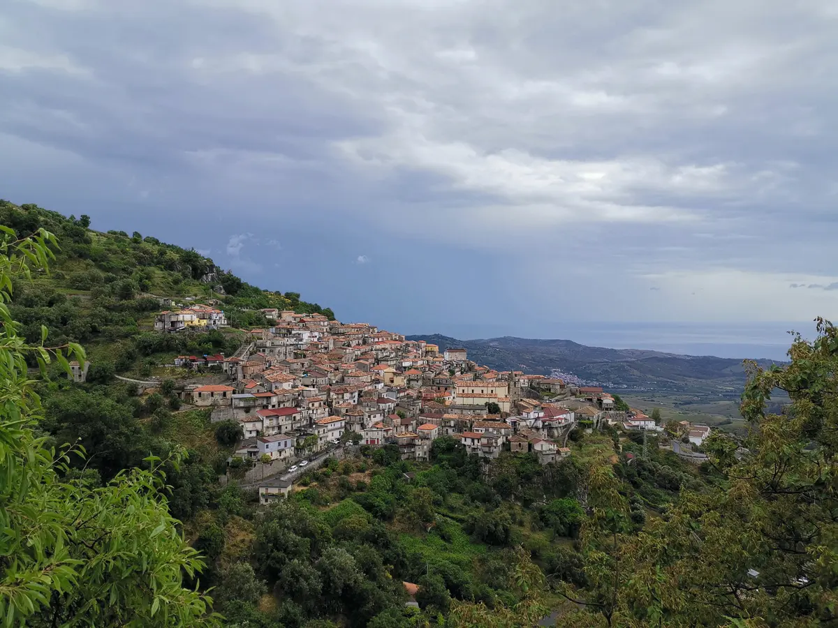
Staiti's unique stepped urban layout, with the houses firmly perched on the sinuous forms of Rocca Giambatore, means that the entire Ionian panorama and the valley of Fiumara Bruzzano can be easily observed from any point.
The village of Staiti still retains the gentle calm and silence befitting ancient hermitages. Staiti is also part of a naturalistic itinerary along the old paths and mule tracks, a ring-route that goes up to the borders of the Aspromonte Park, reaches the ancient Monastery of the Madonna dell'Alica (in the municipality of Palizzi), then Pietrapennata and leads back to the starting point.
A must-see in the village is the Church of Santa Maria dei Tridetti, a rare example of Byzantine architecture in Calabria, the remains of which have already been restored and are located a few kilometres from the town.